Quantcast
Channel: UUV News | Autonomous & Unmanned Underwater Vehicles | ROV News
Viewing all 689 articles
Browse latest View live

Aerojet Rocketdyne to Develop Power Management System for US Navy UUVs

$
0
0

US Navy unmanned underwater vehicle

Aerojet Rocketdyne has announced that it has received a $1.6 million contract from the U.S. Navy to mature the demonstration capabilities of a power and energy management system that will allow underwater unmanned vehicles (UUVs) to be charged wirelessly undersea. Under the contract, Aerojet Rocketdyne will also mature and demonstrate the system’s software capabilities, which will enable the Navy to prioritize and schedule fielded UUVs that require remote recharging.

The concept is part of the Navy’s Forward-Deployed Energy and Communications Outpost (FDECO) program, which was born out of the Office of Naval Research (ONR).

“Aerojet Rocketdyne has a long, successful history of designing and developing highly efficient, reliable and safe electrical power management systems that operate in extreme environments – on land, in space and at sea,” said Aerojet Rocketdyne CEO and President Eileen Drake. “We look forward to leveraging that expertise and working with the Navy to develop a system that will allow UUVs to travel further than ever before, without giving away their presence to potential threats.”

The Navy uses UUVs for a number of purposes, including ocean-floor mapping, optimizing remote sensing platforms, as well as locating and identifying underwater threats such as mines. With Aerojet Rocketdyne’s power and energy management system, the UUVs will be able to recharge wirelessly, upload data and download orders – without having to travel to a port or surface ships. The Navy will also be able to coordinate multiple UUVs needing to be recharged wirelessly via FDECO.

Once Aerojet Rocketdyne matures the engineering hardware and software technologies, the company will exercise those capabilities in a series of U.S. Navy demonstrations.

The post Aerojet Rocketdyne to Develop Power Management System for US Navy UUVs appeared first on Unmanned Systems Technology.


Sparton AHRS Integrated onto Riptide Micro-UUV

$
0
0

Riptide Autonomous Solutions UUV

Sparton Corporation has announced the integration of its Attitude Heading Reference System (AHRS) products onto Riptide Autonomous Solutions’ unmanned undersea vehicles (UUVs). Riptide chose Sparton’s AHRS M-series due to the product’s ability to deliver navigation precision in a very small form factor.

Sparton’s next generation AHRS M-series products deliver heading accuracy as low as 0.2° RMS. The M-series are factory calibrated, fully temperature compensated, micro-sized, light weight, low power systems with an adaptive-calibration mode.

Sparton AdaptCal utilizes a proprietary calibration algorithm that provides continuous 3D adaptive in-field calibration with hard and soft magnetic interference compensation – continuously calibrating out the platform’s magnetic properties on heading accuracy.

The Riptide micro-UUV is a highly flexible open source autonomous undersea vehicle that is suited to developers of autonomy and behaviors, power systems, subsea sensors, and new payloads. The open hardware and software interfaces provide users with a robust platform to advance technology development, making it useful for organizations with undersea survey or science requirements. The micro-UUV is capable of supporting sonar payloads, acoustic communications, 360-degree cameras, as well as flooded payload sections for custom end-user applications.

“2016 was an exceptional growth year for us,” said Jeff Smith, Riptide’s President. “During 2016, Riptide built over two dozen systems and delivered systems to multiple military, academic and commercial customers. We added multiple new development program wins. These next generation AHRS sensors provide another level of navigation precision to the vehicle. Sparton’s adaptive-calibration also greatly enhances the operator’s experience and eliminates the need to perform complex calibration alignment procedures on a moving vessel at sea.”

“Sparton is excited to work with Riptide Autonomous Solutions,” said Jim Lackemacher, Group Vice President of the Engineered Components and Products Segment. “Like Riptide, Sparton aims to be disruptive in their efforts and technology. The AHRS M-series products are a game changer as no other MEMS-based inertial sensor system provides the full mission accuracy and performance with the M-series size.”

The post Sparton AHRS Integrated onto Riptide Micro-UUV appeared first on Unmanned Systems Technology.

3D at Depth and iXblue Develop INS-Aided Subsea LiDAR Data Collection Technology

$
0
0

3D at Depth and IXblue INS-Aided Subsea LiDAR Data Collection

3D at Depth, a provider of advanced subsea LiDAR systems and solutions, has announced the success of a recent trial using Inertial Navigation System (INS) aided LiDAR data collection from a moving platform. The project was jointly sponsored by TechnipFMC and 3D at Depth with inertial navigation partner iXblue. Under the Joint Development Agreement (JDA), 3D at Depth and iXblue successfully integrated and collected motion compensated subsea LiDAR data of an oilfield in water depths greater than 2000 meters. The trial validated the capability of INS aided subsea LiDAR for a variety of applications including field mapping and spool metrology out of straightness. Based on the results, 3D at Depth and iXblue have now developed a commercial version of the INS aided Subsea Laser (SL) mapping solution which will be available for field mapping projects. A second SL mapping solution is under development for a commercialized spoolpiece metrology solution that will launch in the near future.

Overall, the system incorporates 3D at Depth’s SL1 subsea LiDAR system, a Phins INS coupled with a 1200 kHz DVL, iXblue RAMSES and a 3D at Depth Subsea FiT (fiber/time Multiplexer) consolidated into a tightly coupled solution. During the trial, several characterization scanning passes were performed over a flow line and well center infrastructure to determine the preferred altitude and speed. Although these characterization passes added time to the data collection campaign, they provided important information for understanding the optimal parameters for performing field mapping and metrology. The well center and pipeline was surveyed with 25 pipeline transits and 54 well center transits at differing altitude and speeds. Within the 10-hour trial, the INS aided SL1 collected more than 200 million points in 79 passes at altitudes ranging from 2 to 20 meters. The resulting high density point clouds were output into a robust industry standard e57 format that included geo-referenced spatial coordinates and the intensity of each laser pulse. (The intensity value is unique to the SL sensors as this information defines specific features including pipeline field joints, stenciled lettering on structures and umbilical’s on the seabed.)

The initial results demonstrate significant time savings for high resolution subsea mapping at altitudes from 2m to 20m with variable ROV speeds from ROV station keeping in heading control modeup to 2 knots. Post processing analysis of the dynamic point cloud data showed a very close correlation with existing static-scanned point cloud data for the same field.

“iXblue is excited for the opportunity to combine 3D at Depth’s unique time of flight Subsea LiDAR system with the best in class navigation provided by our Phins / Ramses subsea positioning system,” said Jim Titcomb, Offshore Technical Manager, iXblue. “Aiding to Phins utilizing Ramses with two acoustic beacons yielded highly precise results with 3D at Depth reporting 2cm registration delta between the mobile scans and the ground truth data set. Comparing a previous metrology utilizing a static based seabed SubSea LiDAR; scanning methods with the mobile point cloud resulted in a length measurement that differed from the ground truth by only 1.8mm over a range of 22.45m.”

“It is exciting to leverage my background in airborne and space based LiDAR methodologies to subsea applications,” said Brett Nickerson, Co-Founder and Director of Software Engineering, 3D at Depth. “Coupled with iXblue’s high performance inertial navigation technology, the 3D at Depth Systems is the highest resolution and most precise system of its kind for subsea mapping and metrologies.”

The post 3D at Depth and iXblue Develop INS-Aided Subsea LiDAR Data Collection Technology appeared first on Unmanned Systems Technology.

Diakont Provides Underwater Robotic Nuclear Decontamination Service

$
0
0

Diakont Nuclear Decontamination ROV
Diakont, a provider of refueling outage tooling and services to the nuclear industry, has announced that it has successfully provided underwater robotic decontamination services on a nuclear power plant’s refueling cavity and dryer-separator pool using a new ROV (remotely operated vehicle) tool system. Historically, nuclear plant operators have conducted cleaning and decontamination of these surfaces manually, after draining water from the space. However, manual decon is slow, and can result in excessive personnel dose exposure. Robotic methods present a vast improvement over manual decon because it reduces personnel dose exposure, reduces radwaste, doesn’t impact plant chemistry, and doesn’t risk inadvertently spreading contamination. By performing the decon robotically while the cavities are flooded, in many cases the critical path outage schedule can be shortened.

Able to decontaminate horizontal, vertical, and curved surfaces, Diakont’s tools easily navigate to areas within flooded cavities that are inaccessible to previous solutions, performing decon in parallel to other activities including fuel movement. The Diakont tools do not require continuous use of an overhead crane or other method of suspension while performing the decon activities.

The ROV-type decontamination tool attaches and drives along the cavity and component surfaces using a high-force, no-flow vortex generator, even in the presence of Residual Heat Removal (RHR) or shutdown cooling flow. Efficient, effective cleaning is performed using a rugged brushing action to detach the crud, while vacuuming it away at high flow rates to a submerged filter.

At the refueling outage, Diakont’s decontamination services were effective enough that no additional manual cavity decon was required after drain-down. Using the tool’s ability to swim, attach, and crawl, Diakont decontaminated the majority of the surfaces designated by the plant operator. Preliminary surveys indicated that all contamination levels were reduced to

Diakont’s cleaning and decontamination services can be used to service various underwater areas within nuclear power plants, including refueling cavities, spent fuel pools, fuel transfer canals, and drywell heads and other curved surfaces.

“Diakont’s remote decontamination service helped the plant operator meet the INPO/Industry collective radiation exposure goals,” says Jacco Goemans, Director of Nuclear Solutions for Diakont. “Diakont’s new robotic tooling paves the way for plant operators to perform a safer, more efficient, and more effective method of reactor plant decontamination.”

The post Diakont Provides Underwater Robotic Nuclear Decontamination Service appeared first on Unmanned Systems Technology.

New Foam Buoyancy Solution Developed for SuBastian ROV

$
0
0

Schmidt Ocean Institute SuBastian ROV 2
Trelleborg, a developer of polymer solutions, has announced that its applied technologies division has engineered and manufactured a custom syntactic foam buoyancy package for the Schmidt Ocean Institute for use on its new Remotely Operated Vehicle (ROV), SuBastian.

The Schmidt Ocean Institute underwater robotic research program includes the design and development of a 4,500 metre robotic vehicle for use on research vessel Falkor. The ROV is outfitted with a suite of sensors and scientific equipment to support data and sample collection, as well as interactive research, experimentation, and technology development. The buoyancy package on SuBastian is made from Trelleborg’s Eccofloat TG30, a high performance syntactic foam.

Bob Kelly, Managing Director within Trelleborg’s applied technologies operation, says, “We are very proud to be part of this pioneering adventure and to work with Schmidt on developing a syntactic foam that met their requirements. One of the challenges with deep water syntactic foam is producing the lightest possible foam for a given depth which translates into maximum uplift or buoyancy for the vehicle. A high strength to weight ratio means our customers get the industry’s maximum uplift or buoyancy per cubic foot, allowing them to design their vehicle with a lower volume buoyancy package, reducing costs and improving vehicle performance and handling.”

“We were able to create the precise buoyancy package needed for SuBastian, ensuring success for the future commercialisation of this project. The unique customisable design coupled with the selection of Trelleborg’s proven Eccofloat material will provide many years of service with the flexibility to adapt to all future equipment and mission requirements.”

The SuBastian ROV is designed to go to depths of 4,500 metres, which is deeper than the average ocean depth of 3,700 metres. Trelleborg’s Eccofloat TG30 is designed for a service depth of 5,000 metres. The ROV will be suitable to support high resolution seafloor mapping, photomosaicing, video and image gathering, and collections of rocks, animals, and seawater samples. It is equipped with a versatile array of power and data interfaces to enable integration of a wide range of add-on deep sea instruments and samplers that oceanographers may need to support their deep sea research.

SuBastian recently completed its first expedition on newly discovered hydrothermal vent sites, possibly finding new species in the Mariana Back-Arc, an extreme deep-ocean environment. This is the first series of scientific dives for the ROV. Equipped with numerous cameras, including a high-definition 4K video camera, the dives were live streamed onto YouTube and watched by millions. The multidisciplinary team will continue to analyse the data and samples collected during this expedition to advance research on how life thrives on these extreme deep-sea hydrothermal vents. This research was supported by the NOAA Ocean Exploration and Research Program, the NOAA Pacific Islands Regional Office, and the Schmidt Ocean Institute.

The post New Foam Buoyancy Solution Developed for SuBastian ROV appeared first on Unmanned Systems Technology.

General Atomics Provides Lithium-Ion Battery for Department of Defense UUV

$
0
0

General Atomics Lithium-Ion Battery
General Atomics has announced that its Electromagnetic Systems group (GA-EMS) has been awarded a contract to provide its Lithium-ion Fault Tolerant (LiFT) battery system for the Semi-Autonomous Hydrographic Reconnaissance Vehicle (SAHRV), a small, portable unmanned underwater vehicle (UUV). GA-EMS is part of a team working with the Department of Defense to design, fabricate, deliver, and conduct at-sea testing of the LiFT battery system for use on the SAHRV platform. The SAHRV UUV is intended for shallow water surveillance to scan, detect and identify mines and other obstacles.

“Our modular, flexible LiFT battery systems are designed for integration into a wide range of platforms, and have been successfully tested for use on a manned submersible,” stated Scott Forney, president of GA-EMS. “The goal of this new contract is to provide a safe, fault-tolerant, high energy density system that achieves the safety certification approvals required for an unlimited ship carry-on capability and to provide the energy needed to maximize mission assurance whenever and wherever the SAHRV is deployed.”

GA-EMS’ LiFT battery system is designed for use on manned and unmanned underwater vehicles and platforms. LiFT’s single cell fault tolerance prevents uncontrolled cascading cell failure. This ensures the safety of on-board personnel and keeps systems operational through faults to enable mission completion. LiFT has been approved for use and classified by DNV-GL (Det Norske Veritas Germanischer Lloyd).

The post General Atomics Provides Lithium-Ion Battery for Department of Defense UUV appeared first on Unmanned Systems Technology.

New Unmanned Undersea Robot Hunts Invasive Lionfish

$
0
0

Robots in Service of the Environment Guardian LFI undersea robot
Non-profit organization Robots in Service of the Environment (RSE) has announced the development of the Guardian LF1, an unmanned undersea robot designed to control the population of invasive lionfish in the Atlantic, and has launched a Kickstarter campaign to build awareness and support for the project as it enters the next stage of development. Designed to go below sport diver depth down to 400 feet, the Guardian LF1 fully functioning prototypes can stun and collect up to ten lionfish before bringing them to the surface.

The simultaneous launch of the RSE Kickstarter campaign will help decrease populations of the voracious lionfish that is destroying reefs, threatening coastal tourism, challenging the fishing industry, and massively disrupting the Atlantic marine ecosystem. The Kickstarter campaign will help build a community of supporters that will enable creation and effective deployment of the first test fleet of robots to cull targeted populations of lionfish in the Atlantic.

“The lionfish is the perfect invader, a venomous fish with an unquenchable appetite and no natural predators,” said Colin Angle, co-founder and executive chairman of RSE. “The RSE Kickstarter campaign provides an opportunity for the community to get involved in stopping lionfish from further expansion and allowing the recovery of our marine ecosystem.”

RSE will unveil the Guardian LF1 at a #EatLionfish Chefs’ Throwdown in Bermuda hosted by 11th Hour Racing on April 19, ahead of Earth day. In advance of the #EatLionfish Chefs’ Throwdown, the Guardian LF1 has already been used to showcase the important role low-cost robots can play in creating a reliable and sustainable way to bring lionfish meat to market.

The Guardian LF1 undersea robot consists of two main components: an underwater remotely operated vehicle (ROV) with ac apture mechanism, tethered to a remote surface control station. The underwater ROV is deployed from the ocean surface to seek out lionfish which can be located up to several hundred feet below safe sport diver depth. An operator at the surface controls the Guardian LF1 movements via a game controller locating and capturing lionfish. Eight separate thrusters mounted on the ROV enable it to move smoothly in all planes of motion and maintain position regardless of undersea currents using an onboard autopilot.

Once a lionfish has been identified by the operator, through cameras and lights on the ROV, a pair of electrodes mounted on the ROV are used to apply a small electric current to the water near the fish. The operator safely controls the application of this low voltage alternating electric current, activating it for a very short period to stun and immobilize the fish. Similar technology is used regularly by marine biologists in freshwater to humanely capture and release fish unharmed. The RSE team collaborated with experts in the field of electrofishing to adapt this technology for use in salt water.

As soon as the lionfish is immobilized, it is quickly suctioned into a containment vessel on the ROV. An innovative suctioning system was specially designed by the RSE engineering team that requires minimal power while producing a strong flow to draw in the stunned fish. A single robot can capture up to 10 lionfish before returning to the surface. The design is modular which will allow future versions to hold more or fewer fish.

RSE’s solution to the issue of the invasive lionfish has been supported by two programs of The Schmidt Family Foundation: Schmidt Marine Technology Partners, which provided early funding to RSE for research and development, and 11th Hour Racing, which establishes strategic partnerships within the sailing and marine communities to promote collaborative systemic change for the health of the ocean. RSE has also been supported through a strong partnership with the Bermuda Government through their technical experts from the Ministry of the Environment which includes fisheries and marine conservation.

“Lionfish are a formidable threat to the fisheries and reefs in Bermuda and throughout the Western Atlantic,” said Sylvan Richards, Minister of the Environment, Bermuda Government. “Working with RSE to innovate this unique solution allows us to extend our stewardship of Bermuda’s biodiversity to areas we cannot easily reach, and help other jurisdictions facing the same problem.”

The post New Unmanned Undersea Robot Hunts Invasive Lionfish appeared first on Unmanned Systems Technology.

Teledyne Marine Launches New ROV Control Platform

$
0
0

Teledyne Marine Workspace ROV
Teledyne Marine has announced that, in partnership with Greensea Systems, it has developed a new remotely operated vehicle (ROV) control platform that unites the intelligence of Greensea’s proven OPENSEA platform with many of Teledyne’s key technologies. Teledyne Marine Workspace ROV provides customers with a single user interface that enables added functionality and intelligent operation to Teledyne’s imaging, instrumentation, and navigation solutions for a range of ROVs from observation class to work class.

Teledyne Marine Workspace ROV introduces a fully customized interface for ROVs with proven system-level solutions and built-in intelligent capabilities. Incorporation of the OPENSEA architecture enables complete access to support for a vast array of devices and offers modular applications for navigation and vehicle control that increase functionality.

Bowtech video can include system data for a superior customer deliverable, BlueView sonar can be georeferenced and streamed to shore, integrated mission planning with Benthos’ USBL, and the navigational precision of an RDI DVL can be augmented with inertial navigation. With one operating platform visualized through one user interface, Teledyne Marine offers a robust, distributed framework for managing complex underwater robotic environments.

The post Teledyne Marine Launches New ROV Control Platform appeared first on Unmanned Systems Technology.


Robosea Unveils Unmanned Underwater Vehicle with Bionics Technology

$
0
0

Robosea BIKI UUV

Robosea has announced the launch of BIKI, a new unmanned underwater vehicle (UUV) designed with advanced bionics technology. BIKI can be controlled with a physical controller or mobile device app.

Robosea has implemented an advanced bionics technology into BIKI that the company previously invented and developed for an underwater robot with a dual reconfigurable tail fin, which was used to operate in Antarctic regions where the underwater robot played a role in the anthropic exploration into unknown territory.

BIKI’s bionic design minimizes volume and weight and includes an infrared positioning sensor that allows the drone, which resembles a fish, to avoid obstacles automatically and adapt to different complex environments intelligently.

“BIKI can maneuver just about anywhere, and with the use of our trademarked exclusive Robosea Algorithm and IMU (inertial measurement unit), it can keep its balance in the water – allowing self-stabilization to provide smooth videos and sharp photos through its camera platform,” said Dr. Minglei Xiong, CEO of Robosea.

Captured 4k video and pictures can be shared via live transmission to personal mobile devices and social media. In the case of a lost connection, a built-in GPS module makes BIKI automatically return to base or send real-time locations to mobile devices.

“You can also design your own routes for BIKI and, if transmission is somehow lost, it will automatically return to base – all the while sending its real-time location to your mobile device,” added Xiong. “In addition to 4K UHD video, BIKI also supports 16-megapixel photography at 30 fps that offers the best view from underwater – even when operating at high-speed motion or in darkness.”

BIKI operates for up to 90-120 minutes on a single charge, and can operate at depths of nearly 200 feet.

Other features of BIKI include:

  • 4K ultra-high definition (UHD) resolution of 3840 pixels × 2160 lines (8.3 megapixels, aspect ratio 16:9)
  • Compact size (weight of 2.4 pounds, 10.47-inch length, 4.17-inch Width and 5.83-inch height)
  • Durable open shell
  • 1.12 mph fishtail-driven design
  • 55db ultra silent operation
  • 150° Wide-Angle Lens
  • 32 GB Internal Memory
  • 2*114 Lumen Lights

BIKI also applies the technology of ABS crashworthiness and resistance-to-weathering, so in any temperatures from 32-158°F (0 to 70°C), corrosive offshore environments, or under long-term sunlight, BIKI will always remain in good condition.

Find suppliers of Unmanned Underwater Vehicles (UUVs) >

The post Robosea Unveils Unmanned Underwater Vehicle with Bionics Technology appeared first on Unmanned Systems Technology.

Kraken to Provide AquaPix Sonar for AUVs

$
0
0

Kraken Aquapix sonarKraken Sonar Inc. has announced that its wholly-owned subsidiary, Kraken Sonar Systems Inc., has been awarded a repeat contract valued at over C$400,000 by a European defence contractor. Kraken will supply and integrate its AquaPix Miniature Interferometric Synthetic Aperture Sonar and Real-Time SAS Signal Processor on the customer’s Autonomous Underwater Vehicle (AUV).

AquaPix is designed for operation on AUVs, manned and unmanned surface vessels and towed platforms. The modular system uses state-of-the-art electronics, transducer arrays and signal processing software optimized for the demanding size, weight, power and cost constraints of unmanned maritime vehicles.

Karl Kenny, Kraken President and CEO said, “We are very pleased with this repeat contract award from a long-standing customer. AquaPix is an industry leading sonar system providing military grade technology that enables superior 3D seabed imaging, faster data processing and a lower cost than competing sonars. With the increasing international focus on AUV technology, Kraken is well-positioned in this high-priority, high-potential growth area.”

Conventional side scan systems are limited in that they only provide high resolution imagery at short ranges. AquaPix produces ultra high-resolution seabed imagery at long ranges. The additional information provided by AquaPix delivers detection and identification capabilities that cannot be achieved with conventional sidescan sonar. While AquaPix can provide 3 centimetre resolution at ranges up to 300 metres per side, the resolution of even the best side scan sonars is 1 metre or greater at these ranges. Higher resolution allows AquaPix to provide useable area coverage rates up to 10 times better than that of conventional sidescan, which reduces mission time and provides faster actionable intelligence.

AquaPix also generates highly accurate 3D bathymetry data that is registered and geo-referenced to the same pixel grid co-ordinates as the imagery. Operators can simultaneously produce crisp seabed imagery and detailed 3D digital terrain maps of seafloor topography that exceed IHO SP-44 survey standards. The capability of generating centimetre-scale resolution in all three spatial domains also provides significant performance improvements in the detection, classification and identification of small seabed objects.

Autonomous Underwater Vehicles are often utilised as sonar platforms and also can provide an extremely stable platform for acoustic and laser imaging in a variety of water depths. Equipped with next-generation sensors such as Kraken’s AquaPix and SeaVision, AUVs are ideal for a wide variety of underwater defence, commercial and ocean science applications.

The post Kraken to Provide AquaPix Sonar for AUVs appeared first on Unmanned Systems Technology.

Boeing and Huntington Ingalls to Develop UUVs for U.S. Navy

$
0
0

Boeing Echo Voyager UUV

Boeing and Huntington Ingalls Industries have announced that the two firms are teaming on the design and production of Unmanned Undersea Vehicles (UUVs) in support of the U.S. Navy’s Extra Large UUV program.

“This partnership provides the Navy a cost-effective, low-risk path to meet the emergent needs that prompted the Navy’s Advanced Undersea Prototyping program,” said Darryl Davis, president, Boeing Phantom Works. “We are combining Boeing’s preeminent UUV maritime engineering team with our nation’s leading shipbuilder and Navy technical services company to get operational vehicles to the Navy years ahead of the standard acquisition process.”

Boeing is currently testing its newest and largest UUV, Echo Voyager, off the Southern California coast. The vehicle is designed for multiple missions and could include a modular payload bay of up to 34 feet, offering enhanced endurance and increased payload capacity over traditional UUVs. Echo Voyager is fully autonomous, requiring no support vessel for launch or recovery, enabling operation at sea for months before returning to port.

“We look forward to a long relationship with Boeing as we embark together to field this unmanned force-multiplier for the Navy,” said Andy Green, executive vice president of Huntington Ingalls Industries and president of the company’s Technical Solutions division. “I am confident this team will continue redefining the autonomy paradigm for UUVs.”

The partnership will leverage design and production facilities in Huntington Beach, Calif., Newport News, Va., and Panama City, Fla., and will offer access to all of the expertise and capability of Boeing and HII.

The post Boeing and Huntington Ingalls to Develop UUVs for U.S. Navy appeared first on Unmanned Systems Technology.

Teledyne Introduces Ultra-Compact Pathfinder Doppler Velocity Log for ROVs

$
0
0

Teledyne Pathfinder Doppler Log

Teledyne RD Instruments (TRDI) has announced the official launch of its ultra-compact 600 kHz Pathfinder Doppler Velocity Log (DVL). The Pathfinder provides precision, onboard navigation for subsea and surface vehicles in a small footprint for autonomous underwater vehicles (AUVs), remotely operated vehicles (ROVs) and unmanned surface vessels (USVs).

Derived from the company’s long-standing DVL technology, the Pathfinder provides an array of advanced internal algorithms and features that TRDI claims has previously been found only in larger, higher-end solutions. With a bottom tracking range of less than 20cm to over 80m, the Pathfinder 600 is well suited for a wide range of vehicles from the smallest inspection class ROVs and mini AUVs to larger diameter AUVs and Observation class ROVs.

The Pathfinder is available in either self-contained or OEM configurations and can be configured to meet unique vehicle needs.

The post Teledyne Introduces Ultra-Compact Pathfinder Doppler Velocity Log for ROVs appeared first on Unmanned Systems Technology.

KONGSBERG Announces New Autonomous Underwater Glider Systems

$
0
0

Kongsberg ocean gliders

Kongsberg Underwater Technology has announced that it has successfully completed negotiations with CoMotion, the University of Washington’s collaborative innovation hub, to obtain the sole rights to produce, market, and continue development of two new underwater glider systems.

Ocean gliders are a specialised type of autonomous underwater vehicle (AUV). Rather than using a propeller to move through the water, they use fixed wings and changes in buoyancy to achieve both vertical and forward motion. The vehicles move through the water in a saw-tooth trajectory and surface periodically to communicate data on water properties, such as temperature, salinity and oxygen concentration, back to users via satellite telemetry. This form of propulsion is very energy efficient, and allows mission periods of several months and distances of thousands of kilometres, rather than just a few days and tens of kilometres typical of propeller-driven AUVs.

Both new glider systems are based in part on the original, proven Seaglider design. The first vehicle, Deepglider, is designed for operation to a maximum of 6000 meters. This capability will allow the system to completely profile over 97% of the world’s oceans.

The second vehicle, Oculus, is specifically designed for high performance, shallow water operation. Oculus has a high amount of variable buoyancy – 3500 cc – which will allow it to operate from fresh water to sea water without the need to alter its static ballast. It is also capable of achieving horizontal speeds up to 2 knots. These capabilities will enable operations in areas of extreme density variation and high currents.

“We are extremely pleased to be adding Deepglider and Oculus to our underwater glider systems offering,” said Tom Healy, President of Kongsberg Underwater Technology, Inc. “Each vehicle’s unique capabilities fill some key gaps in the marketplace and will allow us to provide solutions to meet a wider range of customer needs.”

“It was gratifying to work with the scientists in the UW School of Oceanography and the UW Applied Physics Lab to streamline the process for transferring and then selecting the best licensee for UW’s autonomous underwater gliders,” said Laura Dorsey, senior technology manager at CoMotion. “UW CoMotion worked through the intricacies of transferring the technology for these complex vehicles and is delighted that KONGSBERG is making them commercially available.”

Development of these glider systems was supported by federal grants from the National Science Foundation, National Oceanic and Atmospheric Administration, and the Department of Navy, Office of Naval Research.

The post KONGSBERG Announces New Autonomous Underwater Glider Systems appeared first on Unmanned Systems Technology.

Sonardyne and 2G Robotics to Develop Underwater Dynamic Laser Mapping

$
0
0

2G Robotics and Sonardyne ROV

2G Robotics and Sonardyne International have announced that the two companies have entered into a formal collaboration agreement. The two organisations are working together on the development and promotion of a dynamic underwater laser mapping solution which significantly reduces the time needed to survey seafloor sites and offshore structures.

The new agreement centres on the integration of Sonardyne’s acoustically-aided inertial navigation system for underwater vehicles, SPRINT-Mapper, with 2G Robotics’ ULS-500 PRO dynamic underwater laser scanner. Projects conducted over the past six months have shown that combining the high resolution afforded by the 2G Robotics’ laser scanner, with a high level of practical positioning accuracy, produces a complete solution for fast and efficient dynamic laser scanning projects. These include archaeological surveys, pipeline and free span inspections, structural integrity monitoring and one of the most demanding of all survey tasks, pipeline metrology.

Until now, attempts at mapping from dynamic platforms have largely involved multi-beam imaging sonars being fitted to ROVs, AUVs and manned submersibles equipped with inertial, Doppler, acoustic positioning and depth instrumentation. As a result of their mobility, large areas can be quickly surveyed but this approach typically only achieves up to 10 cm relative accuracy – effectively ruling out applications like metrology which require centimetre or better accuracy.

The new technique uses the 2G Robotics ULS-500 PRO laser scanner fitted to an underwater vehicle to capture high density point clouds of subsea assets and environments. As the vehicle moves around the site, the SPRINT-Mapper hardware, also fitted to the vehicle, simultaneously collects raw acoustic and inertial navigation data. On completion of the survey, the raw navigational data is post-processed and merged with the laser data to produce a georeferenced 3D point cloud from which centimetric level or better engineering measurements can be taken.

By adopting a dynamic platform such as an ROV navigated using SPRINT-Mapper, the high-resolution laser data is no longer constrained by a stationary deployment location, meaning that an entire site can now be surveyed quickly and with the flexibility to overcome adverse conditions such as visibility. As the underwater vehicle does not have to come into contact with the seabed at the survey site, it can move to scan any target of interest from a variety of perspectives.

Through the agreement, both 2G Robotics and Sonardyne, as well as their distributors, can now offer a complete package for dynamic scanning – effectively eliminating any integration challenges faced by the end customer.

Edward Moller, Global Business Manager for Construction Survey at Sonardyne, said, “The level of detail visible in the post-processed images we’ve gathered on projects in recent months, has to be seen to be believed; small bolt-holes, individual chain links, marine growth and even painted markings can all be clearly seen. In terms of wide-area seabed visualisation, it’s a real game-changer.”

“This new partnership eliminates the complexities most subsea customers face when integrating multiple systems. The detail afforded by the integration of our technologies allows clients to not only capture superior data but also more effectively compete for projects,” commented Chris Gilson, Product Development Manager at 2G Robotics.

The post Sonardyne and 2G Robotics to Develop Underwater Dynamic Laser Mapping appeared first on Unmanned Systems Technology.

Kraken Uses ThunderFish Alpha AUV as Technology Demonstrator Platform

$
0
0

Thunderfish Alpha AUV

Kraken Sonar has announced that its wholly-owned subsidiary, Kraken Sonar Systems, has formally taken delivery of ThunderFish Alpha – a next generation Autonomous Underwater Vehicle (AUV) designed for deep sea military, commercial and scientific applications.

The ThunderFish Alpha AUV (formerly called DEDAVE) was developed by Germany’s Fraunhofer Institute and will be used as a technology demonstrator platform to support ongoing development of Kraken’s underwater sensor and robotics programs.

Kraken previously announced an exclusive licensing agreement for underwater robotics technology with the Fraunhofer Institute, the largest organization for applied research in Europe. Since 2012, Fraunhofer has been developing intellectual property related to underwater robotics. Over C$6 million has been invested in Fraunhofer’s underwater robotics programs, culminating in the development of the DEDAVE AUV, which has now been acquired by Kraken.

The Fraunhofer AUV program was developed to create a versatile and compact vehicle that is easier to handle than existing systems while providing increased modular payload space and faster turn-around survey times. The vehicle can operate in ocean depths up to 6,000 metres and is equipped with state-of-the-art sensor systems, including Kraken’s AquaPix MINSAS sonar. Other sensors include obstacle avoidance sonars, multi-beam echo sounder and advanced navigation/positioning sensors. It incorporates pressure-tolerant battery technology from Kraken Power GmbH, Kraken’s DataPod data storage modules and a distributed control system architecture. This allows the AUV to quickly complete survey missions, offload survey data, enable efficient integration of additional payloads and provide more battery capacity for increased operational endurance.

Kraken plans to upgrade ThunderFish Alpha with larger sensors, including Kraken’s MINSAS 120 sonar with Real Time SAS Processor and its SeaVision 3D Underwater Laser Imaging System. The vehicle size will be increased to support the larger payload capacity and the addition of tunnel thrusters to provide hovering capability for target inspection and precision maneuvering.

While the ThunderFish Alpha platform will be used primarily as a technology demonstration platform, it will also test operational performance related to maritime Robotics as a Service.

Karl Kenny, Kraken’s President and CEO, said, “The delivery of ThunderFish Alpha is yet another milestone in Kraken’s evolution to becoming a vertically integrated underwater robotics company. Over the past few years, AUVs have evolved from an emerging, niche technology to a viable solution and an established part of operations in military, commercial and research applications. The recent shift in industry focus from AUVs being platform/hardware-centric to becoming sensor/software-centric is creating significant sector growth potential for cost-effective and autonomous platforms.”

The post Kraken Uses ThunderFish Alpha AUV as Technology Demonstrator Platform appeared first on Unmanned Systems Technology.


ECA Group Demonstrates Simultaneous MCM Drone Operation to Belgian Navy

$
0
0

ECA Group USV with AUVs

ECA Group has announced that it has demonstrated the capability to simultaneously deploy its AUVs (Autonomous Underwater Vehicles), USVs (Unmanned Surface Vessels) and ROVs (Remotely Operated Vehicles) to perform parallel and collaborative detection and identification of mines during Mine Counter Measures (MCM) operations. The demonstration was performed for the Belgian Navy, which is currently undergoing evaluation of unmanned maritime systems.

Legacy MCM operations, as performed since the 1970s, have consisted of employing a dedicated minehunter equipped with dual frequency hull-mounted sonar for detection and classification of sea-bottom objects, and ROVs for identification and neutralization. With the recent evolutions in drone technology enabling the systems to collaborate and become more autonomous even in complex missions and to have increased operability distance, MCM operations are now moving to multi-type unmanned platform swarms, thus increasing the capabilities of a single support ship whilst reducing the time of operation and ensuring crew safety.

In the harsh subsea conditions of the North Sea, including poor visibility and strong currents, ECA Group deployed an Unmanned MCM Integrated System (UMIS) composed of an A9-M AUV and an INSPECTOR USV with two SEASCAN MK2 ROVs from the Coastal Patrol Vessel (CPV Pollux) of the Belgian Navy. In parallel, another of ECA’s AUVs, the long range A27-M, was also operated from the same CPV with the support of ECA Group personnel.

This set of vehicles was deployed within an evaluation area for a predefined MCM mission. Through its radio and acoustic communication links, ECA was able to demonstrate the capability to operate in parallel, with real-time cooperative actions between a large number of unmanned vehicles while operators remained aboard the CPV in a safe zone several kilometers outside of the mine field. After only a few minutes the first contact snapshots automatically generated by the Automatic Target Detection software in the AUV A9-M and relayed by the USV were received on the CPV and the classification process could begin immediately while the AUV continued its survey mission following a subsea preprogrammed pattern.

The USV INSPECTOR was immediately sent to the locations of the shortlisted classified objects of interest in order to deploy the SEASCAN inspection vehicle. This ROV was remotely operated using the subsea optical fiber from the USV and the latter’s radio link to the operator aboard the CPV in order to carry out the final visual camera identification.

All the collected data from this operation is to be examined by the Belgian Navy in order to evaluate the performances of the ECA unmanned MCM integrated system. This mission allowed ECA to gain valuable experience in real operational conditions and was a great opportunity for the Belgian Navy to test the latest operational MCM concepts.

The post ECA Group Demonstrates Simultaneous MCM Drone Operation to Belgian Navy appeared first on Unmanned Systems Technology.

New Consumer Underwater Drone Dives to 150 Metres

$
0
0

BlueEye Pioneer underwater drone

Blueye Robotics has announced the introduction of the Pioneer, an underwater drone that can dive up to 150 meters – eight times deeper than the average scuba enthusiast. The Pioneer has capabilities that are usually found in professional equipment used by filmmakers, oceanographers and the military, but is aimed at the consumer market.

Blueye Pioneer’s HD wide-angle video camera uses special technologies that work in low-light conditions and can communicate true-color images, overcoming the problem of how colors change below 16 feet underwater.

“Red colors start to fade, and the undersea world becomes green or blue,” explained Christine Spiten, Co-founder and Strategy Director of Blueye Robotics. “A custom algorithm was developed to add color back in to photos and video captured by the Pioneer. Now the mysterious realm of the ocean will be accessible to anyone with a smartphone, tablet or PC in full HD quality.”

Developed in the extreme conditions of the Arctic Ocean, Blueye Pioneer has a unique combination of compact size (15 lbs.), power (three robust thrusters) and stability. It can perform in rough currents and low temperatures thanks to its hydrodynamic balancing design. Blueye Pioneer travels at a speed of 2.5 meters/second (5 knots).

Scientists may use Pioneer for environmental monitoring, and fish farmers, owners of offshore wind parks and other ocean-based enterprises can also utilize the drone’s capabilities to stay in control of their underwater operations. Early customers include The Norwegian Society for Search and Rescue, Redningsselskapet and the World Wildlife Fund (WWF).

The post New Consumer Underwater Drone Dives to 150 Metres appeared first on Unmanned Systems Technology.

Kraken AUV to Search for Lost Canadian Test Aircraft

$
0
0

Kraken Thunderfish AUV

Kraken Sonar Inc. has announced that its wholly-owned subsidiary, Kraken Sonar Systems Inc., has been awarded its first “Robotics as a Service” contract by OEX Recovery Group Incorporated, to conduct a search for nine Avro Arrow free flight models launched over Lake Ontario in a series of tests during 1954 – 1957. The models are one-eighth scale replicas of the famous flying jet, and were part of the final flight design tests done prior to the production of the CF-105 Arrow. The goal of the search is to discover the resting place of nine models, recover them and ultimately house them at the Canada Aviation and Space Museum in Ottawa and the National Air Force Museum of Canada in Trenton, Ontario.

The search and recovery program is a Canada 150 collaborative effort spearheaded by Osisko group companies Osisko Mining Inc. and Osisko Gold Royalties Ltd., in collaboration with their financial partners at National Bank, the Bank of Montreal, Canaccord Genuity, Maxit Capital, Eight Capital and Northfield Capital; the Canada Aviation and Space Museum (CASM), Royal Canadian Air Force (RCAF), the Canadian Conservation Institute and Bennett Jones LLP. Support for this project is also being provided by the Canadian Coast Guard, the Royal Canadian Military Institute and Canada Company.

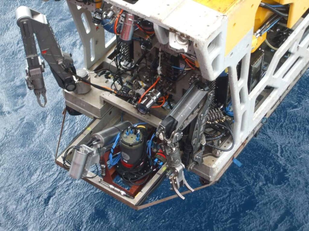
Kraken will deploy its ThunderFish Autonomous Underwater Vehicle (AUV) and AquaPix Synthetic Aperture Sonar (SAS) system in Lake Ontario to search for the Avro Arrow models. The advanced Canadian jet fighter and development program was abruptly cancelled in 1959 by the government of the day.

The CF-105 Arrow performed incredibly well during in-flight tests and many thought it would put Canada at the forefront of military aviation. When the program was cancelled in 1959, over 30,000 employees and sub-contractors lost their jobs as a direct result of the program’s cancellation. Many Avro engineers went on to work at Lockheed, Boeing and NASA, and others to Britain to work in the aerospace industry there.

When the program was cancelled, all materials related to the Avro Arrow were ordered destroyed, including six completed jet fighters, production tooling and all development related materials. The only known artifacts from the program remaining to be found are the free flight test models, which for over sixty years have rested somewhere on the bottom of Lake Ontario. These models were the flying replicas of the actual aircraft and the last step from design testing prior to production of the actual flying jets. While the full-size Arrow measured 24 metres long with a 15-metre wingspan, each test model was just 3 metres long with a wingspan of 2 metres.

The free flight models were successively increased in sophistication, and were launched over Lake Ontario in a series of flights conducted between 1954 and 1957 to test the aerodynamic qualities of the aircraft design. The free flight models were attached to high-powered booster rockets and launched out over the lake from a military test site east of Toronto. After separating from the booster rockets the models flew at supersonic speeds. Their onboard sensors, revolutionary for the 1950s, transmitted flight data back to engineers on the ground. At the end of each flight the models lost velocity, crashed into the water and sank.

In the past, privately funded missions have attempted to locate and recover the lost models, but all have failed due to inadequate funding, water depths, search area size and the amount of metal debris on the bottom – according to military records, more than 600 missiles were launched from the same site, which was also used as an artillery range in the 1930’s.

The search for the Arrow models began with detailed analysis of historical information to narrow the search area as much as possible. In the Arrow’s case, scientists, engineers and historians from the Osisko group, Kraken and the RCAF used historical research, the collection of archival material at CASM, interviews with former Avro employees and computer-aided trajectory and flight data modeling to develop the search grids.

David Shea, Kraken’s VP of Engineering said, “We are very pleased to receive the first contract to validate our Robotics-as-a-Service business model – to build, own, operate and maintain our own vertically integrated robotic systems. ThunderFish is a Kraken Autonomous Underwater Vehicle, using Kraken’s AquaPix sonar and leveraging other Kraken-owned underwater technologies including batteries, thrusters, and artificial intelligence.”

Mr. Shea continued: “Our AquaPix MINSAS technology provides extremely high-resolution images and unparalleled area coverage rates in a compact, low power package. Onboard real-time processing enables on-the-fly beamforming and geo-referencing, which significantly reduces the overall processing timeline, a critical factor in these types of search and salvage applications.”

“AquaPix was a proven payload during the Franklin Expedition in 2014, operating onboard a Royal Canadian Navy AUV. We deployed the AUV in the morning, all processing occurred onboard the AUV in real-time, and after recovering the vehicle in the evening we immediately began reviewing the already-processed sonar images, with zero post processing required. Leveraging what we’ve learned from that experience, I can say with confidence that we have the right people using the right technology for this expedition.”

Traditional sonar systems have a range and resolution limited by the size and frequency of their acoustic array. Kraken’s AquaPix SAS technology provides an order of magnitude increase in range and resolution by using sophisticated software and signal processing to “synthesize” an array up to 25x longer than the real array. The AquaPix SAS is integrated into Kraken’s ThunderFish AUV – a battery powered, unmanned, untethered submersible. ThunderFish is pre-programmed to survey a specific area each day. After deployment, it autonomously transits to the search area, dives to depth and surveys the area using the AquaPix SAS and other sensors. Upon mission completion, it returns to shore for recovery, data download and battery charging.

John Burzynski, President and CEO of Osisko Mining Inc. and head of OEX Recovery Group Inc. stated: “As professional explorers in the mining business, we initiated this program about a year ago with the idea of bringing back a piece of lost Canadian history to the Canadian public. As individuals, as a company, as a group, and with our partners and our project participants in this search effort, we all have the same goal in mind: to find and return these beautiful pieces of Canadian technology to the public eye, during this anniversary year of our country.”

Karl Kenny, Kraken President & CEO said, “During our 150th birthday, I can’t think of a better example of how advanced Canadian ocean technology is being used to search and find advanced Canadian aerospace technology. This expedition is sure to be nostalgic for the countless fans of the Avro Arrow – which became a symbol of world-class Canadian technology. Continuing in the tradition of the Arrow, the entire Kraken team is very proud to engineer and build world-class Canadian underwater robotics technology.”

The post Kraken AUV to Search for Lost Canadian Test Aircraft appeared first on Unmanned Systems Technology.

Seawater Batteries to Power Long-Range Unmanned Underwater Vehicles

$
0
0

OpenWater Power UUV battery

MIT has announced that its spinout company Open Water Power (OWP), recently acquired by major tech firm L3 Technologies, has developed a novel aluminum-water power system that will improve the range of unmanned underwater vehicles (UUVs).

The power systems could find a wide range of uses, including helping UUVs dive deeper, for longer periods of time, into the ocean’s abyss to explore ship wreckages, map the ocean floor, and conduct research. They could also be used for long-range oil prospecting out at sea and various military applications.

OWP is currently working with the U.S. Navy to replace batteries in acoustic sensors designed to detect enemy submarines. The startup will soon launch a pilot with Riptide Autonomous Solutions, which will use the UUVs for underwater surveys. Currently, Riptide’s UUVs travel roughly 100 nautical miles in one go, but the company hopes OWP can increase that distance to 1,000 nautical miles.

“Everything people want to do underwater should get a lot easier,” says co-inventor Ian Salmon McKay, who co-founded OWP with fellow graduates Thomas Milnes and Ruaridh Macdonald.

Most UUVs use lithium-based batteries, which have several issues. They are known to catch fire, meaning that UUV-sized batteries are generally not shippable by air. Their energy density is limited, meaning that expensive service ships carry UUVs to sea, recharging the batteries as necessary. The batteries also need to be encased in expensive metal pressure vessels.

OWP’s power system consists of an alloyed aluminum, a cathode alloyed with a combination of elements (primarily nickel), and an alkaline electrolyte that is positioned between the electrodes. When a UUV equipped with the power system is placed in the ocean, sea water is pulled into the battery, and is split at the cathode into hydroxide anions and hydrogen gas. The hydroxide anions interact with the aluminum anode, creating aluminum hydroxide and releasing electrons. Those electrons travel back toward the cathode, donating energy to a circuit along the way to begin the cycle anew. Both the aluminum hydroxide and hydrogen gas are jettisoned as harmless waste. Components are only activated when flooded with water. Once the aluminum anode corrodes, it can be replaced at low cost.

McKay says. “Our power system can drink sea water and discard waste products,” he says. “But that exhaust is not harmful, compared to exhaust of terrestrial engines.”

With the aluminum-based power system, UUVs can launch from shore without the need for service ships, opening up new opportunities and dropping costs. With oil prospecting, for example, UUVs currently used to explore the Gulf of Mexico need to hug the shores, covering only a few pipeline assets. OWP-powered UUVs could cover hundreds of miles and return before needing a new power system, covering all available pipeline assets.

After the Malaysian Airlines crash in 2014, UUVs were recruited to search areas that were infeasible for equipment on the other vessels. McKay said: “In looking for the debris, a sizeable amount of the power budget for missions like that is used descending to depth and ascending back to the surface, so their working time on the sea floor is very limited,” he says. “Our power system will improve on that.”

The OWP technology started as the co-founders’ side project, which was modified throughout two MIT classes and a lab.
The class was charged with developing an alternate power source for UUVs. McKay gambled on an energy-dense but challenging element: aluminum. One major challenge with aluminum batteries is that certain chemical issues make it difficult to donate electrons to a circuit. Additionally, the product of the reactions, the aluminum hydroxide, sticks to the electrode’s surface, inhibiting further reaction. McKay was able to overcome the first challenge by making a gallium-rich alloyed aluminum anode that successfully donated electrons, but it corroded very quickly.

Seeing potential in the battery, Milnes joined McKay in further developing the battery as a side project. The two began developing electrolytes and alloys that inhibit parasitic corrosion processes and prevent that aluminum hydroxide layer from forming on the anode.

Establishing themselves at Greentown Labs in Somerville, Massachusetts, where the company still operates with about 10 employees, OWP further refined the power system’s design. The system now uses a pump to circulate the electrolyte, scooping up unwanted aluminum hydroxide on the anode and dumping it onto a custom precipitation trap. When saturated, the traps with the waste are ejected and replaced automatically. The electrolyte prevents marine organisms from growing inside the power system.

Now OWP’s chief science officer, McKay says the startup owes much of its success to MIT’s atmosphere of innovation, where many of his professors readily offered technical and entrepreneurial advice and allowed him to work on extracurricular projects.

“It takes a village,” McKay says. “Those classes and that lab are where the idea took shape. People at MIT were doing strong science for science’s sake, but everyone was keenly aware of the possibility of bringing technologies to market. People were always having those great ‘What if?’ conversations — I probably had three to four different startup ideas in various stages of gestation at any given time, and so did all my friends. It was an environment that encouraged the playful exchange of ideas, and encouraged people to take on side projects with real prizes in mind.”

SOURCE: MIT News

The post Seawater Batteries to Power Long-Range Unmanned Underwater Vehicles appeared first on Unmanned Systems Technology.

ECA Group Demonstrates Advanced AUV Robotics Features

$
0
0

ECA Group A9-E AUV

ECA Group has announced that it has successfully demonstrated new advanced robotic features on an experimental version of its A9-E AUV (autonomous underwater vehicle). The AUV had been specially modified for the SWARMS project, an EU-funded directive to develop new technologies for underwater robotics. The modifications included an extra acoustic modem with network protocols from Evologics fitted in a modified front payload section, and an additional advanced autonomy interface with on-board computing capabilities.

The new modem allowed for the inclusion of the experimental A9-E AUV within a multiple access-capable underwater communication network. While ECA Group routinely uses underwater communications for mission monitoring and control, these have been mostly point to point until now. The use of a multiple access acoustic network deconflicts the use of multiple vehicles operating in the same area. Using an unmanned surface vehicle (USV) as a WiFi and RF gateway, a status vector including AUV position, speed, etc was successfully displayed on the topside SWARMS multi-vehicle mission management tool.

The advanced autonomy interface was developed to allow mission parameters to be adapted on the fly. In previous modes of operation, only a pre-programmed mission plan was usually executed. To test this new capability, real-time quality analysis and control of a bathymetric survey conducted using a COTS Klein 3500 interferometric side-looking sonar was demonstrated. A quality factor was extracted in real-time, on-board the experimental A9-E, from the raw sonar data. This quality factor measures the interferometric baseline decorrelation, which can result from many factors including reduced signal to noise, or multipath interference in shallow water, and degrades the accuracy of the depth soundings. The quality factor measurement was used to adapt the altitude of the survey between 4m and 6m (water depth varied from 5m to 8m over the test area) to minimize the baseline decorrelation and therefore increase the accuracy of the soundings.

ECA Group’s demonstration was held in the access channel to the Black Sea port of Mangalia, Romania.

The post ECA Group Demonstrates Advanced AUV Robotics Features appeared first on Unmanned Systems Technology.

Viewing all 689 articles
Browse latest View live


<script src="https://jsc.adskeeper.com/r/s/rssing.com.1596347.js" async> </script>